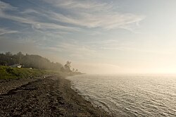
Grand-Métis
Grand-Métis | |
|---|---|
 | |
 Location within La Mitis RCM | |
| Coordinates: 48°38′N 68°08′W / 48.63°N 68.13°W[1] | |
| Country | |
| Province | |
| Region | Bas-Saint-Laurent |
| RCM | La Mitis |
| Constituted | September 13, 1855 |
| Government | |
| • Mayor | Marc-André Larrivée |
| • Federal riding | Haute-Gaspésie—La Mitis—Matane—Matapédia |
| • Prov. riding | Matane-Matapédia |
| Area | |
| • Total | 25.30 km2 (9.77 sq mi) |
| • Land | 25.12 km2 (9.70 sq mi) |
| Population | |
| • Total | 218 |
| • Density | 8.7/km2 (23/sq mi) |
| • Pop 2016-2021 | |
| • Dwellings | 206 |
| Time zone | UTC−5 (EST) |
| • Summer (DST) | UTC−4 (EDT) |
| Postal code(s) | |
| Area code(s) | 418 and 581 |
| Highways | |
| Website | www.municipalite. grand-metis.qc.ca |
Grand-Métis is a municipality in the La Mitis Regional County Municipality within the Bas-Saint-Laurent region of Quebec, Canada. It is situated where the Mitis River meets the Saint Lawrence River, and was developed from 1818 by the pioneering John MacNider.
The names "Métis" and "Mitis" are said to come from a Mi'kmaq word meaning "meeting place" or another referring to willow or poplar trees.
Demographics
[edit]In the 2021 Census of Population conducted by Statistics Canada, Grand-Métis had a population of 218 living in 122 of its 206 total private dwellings, a change of 2.3% from its 2016 population of 213. With a land area of 25.12 km2 (9.70 sq mi), it had a population density of 8.7/km2 (22.5/sq mi) in 2021.
Population
[edit]| 2021 | 2016 | 2011 | |
|---|---|---|---|
| Population | 218 (+2.3% from 2016) | 167 (-29.5% from 2011) | 237 (-11.6% from 2006) |
| Land area | 25.12 km2 (9.70 sq mi) | 25.55 km2 (9.86 sq mi) | 25.66 km2 (9.91 sq mi) |
| Population density | 8.7/km2 (23/sq mi) | 6.5/km2 (17/sq mi) | 9.2/km2 (24/sq mi) |
| Median age | 59.2 (M: 59.2, F: 58.8) | 59.2 (M: 61.0, F: 55.5) | 55.5 (M: 56.9, F: 53.5) |
| Private dwellings | 206 (total) 122 (occupied) | 191 (total) | 176 (total) |
| Median household income | $37,376 |
| Year | Pop. | ±% |
|---|---|---|
| 1921 | 2,645 | — |
| 1921 | 1,903 | −28.1% |
| 1931 | 289 | −84.8% |
| 1941 | 577 | +99.7% |
| 1951 | 383 | −33.6% |
| 1956 | 439 | +14.6% |
| 1961 | 414 | −5.7% |
| 1966 | 387 | −6.5% |
| 1971 | 356 | −8.0% |
| 1976 | 339 | −4.8% |
| 1981 | 342 | +0.9% |
| 1986 | 327 | −4.4% |
| 1991 | 287 | −12.2% |
| 1996 | 276 | −3.8% |
| 2001 | 281 | +1.8% |
| 2006 | 268 | −4.6% |
| 2011 | 237 | −11.6% |
| 2016 | 213 | −10.1% |
| 2021 | 218 | +2.3% |
Attractions
[edit]The historic Reford Gardens (Jardins de Métis) are located nearby. These gardens, now maintained by Les Amis des Jardins de Métis, are the result of Elsie Reford's extraordinary passion for horticulture. An International Garden Festival is held here each summer. The garden's symbol, the Himalayan Blue Poppy (Meconopsis betonicifolia), can be found growing there in summer. The gardens were designated a National Historic Site of Canada in 1995.[9]
See also
[edit]References
[edit]- ^ "Banque de noms de lieux du Québec: Reference number 79838". toponymie.gouv.qc.ca (in French). Commission de toponymie du Québec.
- ^ a b "Répertoire des municipalités: Geographic code 09060". www.mamh.gouv.qc.ca (in French). Ministère des Affaires municipales et de l'Habitation.
- ^ a b c "2021 Community Profiles". 2021 Canadian census. Statistics Canada. February 4, 2022. Retrieved 2023-10-19.
- ^ "2016 Community Profiles". 2016 Canadian census. Statistics Canada. August 12, 2021. Retrieved 2022-07-27.
- ^ "2011 Community Profiles". 2011 Canadian census. Statistics Canada. March 21, 2019. Retrieved 2022-07-27.
- ^ "2006 Community Profiles". 2006 Canadian census. Statistics Canada. August 20, 2019.
- ^ "2001 Community Profiles". 2001 Canadian census. Statistics Canada. July 18, 2021.
- ^ Statistics Canada: 1996, 2001, 2006, 2011, 2016 , 2021 census
- ^ Jardins de Métis. Canadian Register of Historic Places. Retrieved 1 April 2012.
External links
[edit]![]() Media related to Grand-Métis at Wikimedia Commons
Media related to Grand-Métis at Wikimedia Commons

