Seongju County
Appearance
Seongju
성주군 | |
|---|---|
| Korean transcription(s) | |
| • Hangul | 성주군 |
| • Hanja | 星州郡 |
| • Revised Romanization | Seongju-gun |
| • McCune-Reischauer | Sŏngju-gun |
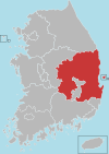
 Location in South Korea | |
| Country | |
| Region | Yeongnam |
| Administrative divisions | 1 eup, 9 myeon |
| Area | |
| • Total | 616.28 km2 (237.95 sq mi) |
| Population (September 2024[1]) | |
| • Total | 41,591 |
| • Density | 82.8/km2 (214/sq mi) |
| • Dialect | Gyeongsang |
Seongju County (Seongju-gun) is a county in North Gyeongsang Province, South Korea. This largely agricultural area is located immediately west of the metropolitan city of Daegu. The capital of the county is the town of Seongju.
Lotte Skyhill Seongju Country Club (36°02′58″N 128°13′34″E / 36.049359°N 128.226223°E) was selected as the location for the deployment of Terminal High Altitude Area Defense (THAAD) system in July 2016.[2][3]
Seongju County is famous for its production of oriental melons. Farms in the county comprise about 70% of total oriental melon production in the country.[4]
Administrative divisions
[edit]
Seongju County is divided into 1 eup and 9 myeon.
| Name | Hangeul | Hanja |
|---|---|---|
| Seongju-eup | 성주읍 | 星州邑 |
| Seonnam-myeon | 선남면 | 船南面 |
| Yongam-myeon | 용암면 | 龍岩面 |
| Suryun-myeon | 수륜면 | 修倫面 |
| Gacheon-myeon | 가천면 | 伽泉面 |
| Geumsu-myeon | 금수면 | 金水面 |
| Daega-myeon | 대가면 | 大家面 |
| Byeokjin-myeon | 벽진면 | 碧珍面 |
| Chojeon-myeon | 초전면 | 草田面 |
| Wolhang-myeon | 월항면 | 月恒面 |
Twin towns – sister cities
[edit] Gwanak-gu, South Korea (2005)
References
[edit]- ^ "Population statistics". Korea Ministry of the Interior and Safety. 2024.
- ^ "THAAD's new home will be golf course in South Korean mountains". STARS AND STRIPES. September 30, 2016.
- ^ Kang Seung-woo (13 July 2016). "Seongju confirmed as site for THAAD". The Korea Times. Retrieved 15 September 2016.
- ^ "韓国農水産食品-チャメ(マクワウリ)[Kankoku Nōsui-san shokuhin - chame (makuwauri)]". www.atcenter.or.jp (in Japanese). Korea Agro-Fisheries Trade Corporation. Retrieved 2018-09-17.


